
We booked a self-guided hiking trip in Switzerland with Alpenwild and loved every minute of it. They were very knowledgeable and easy to work with, paying attention to what we wanted to do and what level of hiking we were looking for. Different options were offered for hiking each day, with tips and advice that was always helpful. The hotels they booked for us were family-run and excellent. Everything unfolded smoothly with no surprises - a truly fabulous vacation. - C.R., Vancouver B.C.
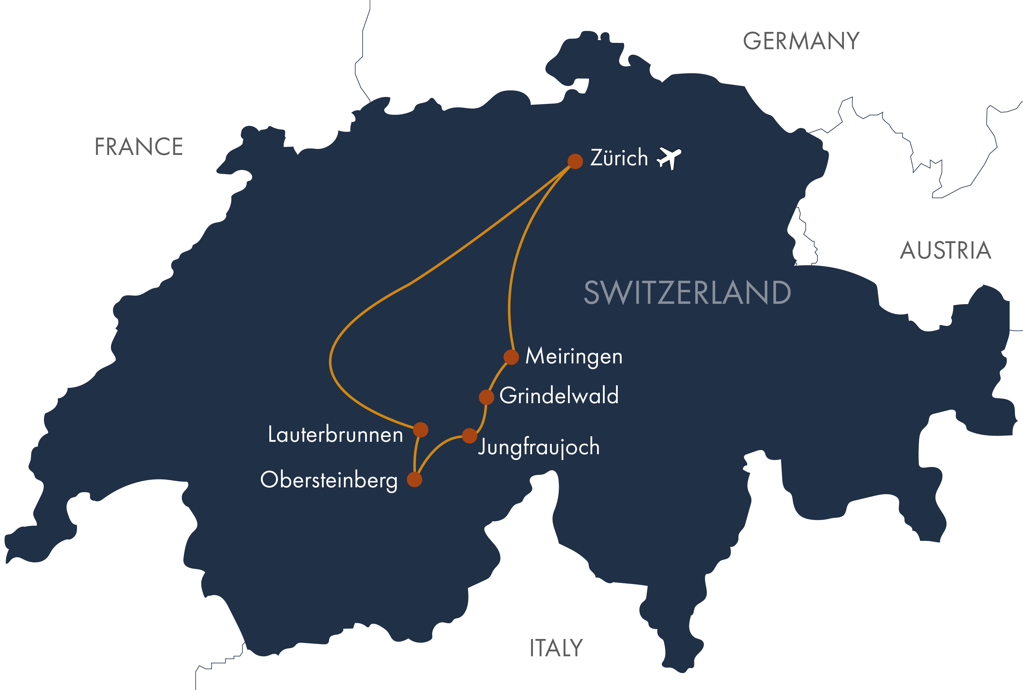
Take the train from Zurich to Lauterbrunnen (3 hours). Enjoy an afternoon walk to Trümmelbach Falls, a series of 10 glacier-fed waterfalls cascading through the mountain and draining the Eiger, Mönch, and Jungfrau glaciers.
Distance: 2–4 miles (3–6.5 km) | Terrain: Level walk
Today, take the cable car from Lauterbrunnen to Grütschalp, where you’ll begin hiking along the Mountain View Trail to Allmendhubel, perched high on a mountain shelf overlooking the Lauterbrunnen Valley. Stop for lunch and enjoy the circular Flower Trail before continuing along the Northface Trail down to the car-free village of Mürren. From Mürren, take the train back to Grütschalp and the cable car down to Lauterbrunnen. Overnight in Lauterbrunnen. (B)
Distance: 7.2 miles (11.6 km) | Ascent: 2,050 feet (625 m) | Descent: 1,503 feet (458 m)
From Lauterbrunnen, travel to Stechelberg, where you’ll hike along a mountain trail to the remote Berghotel Obersteinberg, with postcard-perfect views of Schmadrifall and the scenic head of the Lauterbrunnen Valley. In the afternoon, you can take an optional hike to the upper glacial basin of Oberhornsee for breathtaking views of the Jungfrau region before returning to Obersteinberg. Overnight at Berghotel Obersteinberg. Bring an overnight bag, as your main luggage will be transferred to Grindelwald. (BD)
Distance: 3.5–8 miles (5.6–12.9 km) | Ascent: 2,850–3,792 feet (869–1,156 m) | Descent: 942 feet (287 m) with the optional Oberhornsee hike.
This morning, hike down from Obersteinberg to Stechelberg before continuing toward Grindelwald. Pause briefly in the car-free village of Wengen, then take a cable car up to Männlichen. From there, traverse the breathtaking Panorama Ridge Trail—also known as the Royal Walk—leading to Kleine Scheidegg, where sweeping vistas of the Eiger, Mönch, and Jungfrau dominate the horizon. From Kleine Scheidegg, board the train to Grindelwald, carrying memories of this stunning alpine journey. Overnight in Grindelwald. (B)
Distance: About 7 miles (11.3 km) | Ascent: 50 feet (15 m) | Descent: 3,700 feet (1,128 m)
Ride the Eiger Express V-Bahn cable car up to Eigergletscher, then embark on an exhilarating cogwheel train journey through a tunnel inside the Eiger, ascending to the Jungfraujoch—the highest railway station in Europe. Take in sweeping views of the Alps’ longest glacier before choosing your adventure: a scenic Eiger Walk down to Kleine Scheidegg or a longer, dramatic hike along the Eiger Trail at the foot of the legendary Eiger Mountain. Overnight in Grindelwald. (B)
Distance: 4–6 miles (6.4–9.7 km) | Ascent: 75–775 feet (23–236 m) | Descent: 2,400–3,000 feet (732–914 m)
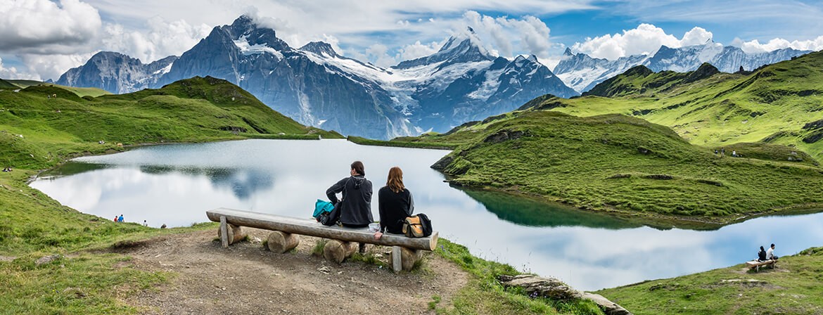
Take the cable car up to “First” and hike to the sparkling Bachalpsee, framed by the snowcapped peaks and glaciers of the Jungfrau region. Continue along the breathtaking Faulhorn Panorama Trail, with views stretching into Germany, and climb to Faulhorn for lunch at Switzerland’s oldest mountain hotel. Afterward, return to the First cable car station and descend to Grindelwald—choose a thrilling ride by zipline, mountain cart, or trottibike, or take the cable car for a more relaxed finish. Overnight in Grindelwald. (B)
Distance: 3.7–7.4 miles (6–12 km) | Ascent: 500–2,900 feet (152–884 m) | Descent: 500–1,760 feet (152–536 m)
Crossing the Grosse Scheidegg has been celebrated as a highlight of any Swiss journey since the 18th century. Traverse this stunning pass, where awe-inspiring views of the Wetterhorn, Schreckhorn, and other towering Bernese Alps peaks unfold before you. From Grosse Scheidegg, descend into the enchanting Rosenlauital Valley, winding along the Romanticweg through lush forests and beside rushing streams, before reaching the picturesque town of Meiringen—a perfect reward after a day of high-alpine adventure. Overnight in Meiringen. (B)
Distance: 7–8.3 miles (11.3–13.4 km) | Ascent: 0–233 feet (0–71 m) | Descent: 2,664–3,030 feet (812–924 m)
Onward Departure. We can give you more options if you choose to extend your trip. Note: it is a 2.5-3 hour train ride to Zürich airport, and the first train departs Meiringen at 5:41 am, so plan departure flights accordingly. We can recommend hotels in Zürich if needed. (B)
Daily distance measurements may vary depending on the device you use to track them. If a range is provided for the statistics, it is possible to hike closer to the lower end, and we’ll include options in your detailed daily directions. Use the listed figures as estimates and reference points while preparing and training for this tour.
We rate this trip as moderate. Please note that the stats listed on the itinerary can vary depending on the desires of our hikers. Many of the hikes are easily adaptable and can be lengthened or shortened. You should be a strong and experienced hiker in good physical condition. You should be capable of walking 4 to 7 hours per day on good trails, ascending up to about 3,000 vertical feet per day, at an elevation up to 9,000 feet above sea level.