

“Our guide was fabulous. The hotels and restaurants were incredible; Tari from the office did a wonderful job selecting them. The hikes, of course, were terrific.” - Via Alpina guest
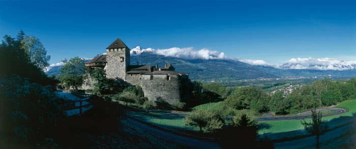
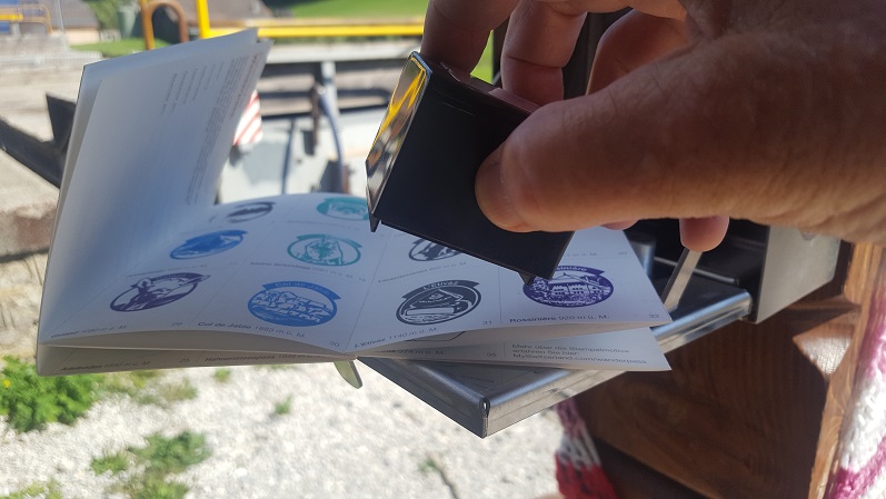
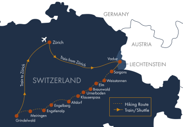
Arrive by train in Sargans or Buchs, Switzerland, then take a bus to Vaduz, the capital city of the mountain principality of Liechtenstein. The tour will start at 2:00 pm, where we’ll take a short warm-up walk up to the Vaduz Castle, the palace and residence of Liechtenstein’s ruling family. There is no border control between Switzerland and Liechtenstein, but you'll want to stop at the tourism office to have your passport ceremonially stamped. Then take a photo of yourself standing on the official starting point of the Via Alpina in the pedestrian center of cosmopolitan Vaduz. In the evening, we will have an orientation and welcome dinner. Overnight in Vaduz, Liechtenstein. (D)
Ascent 400 feet | Descent 400 feet | Distance: 2 miles (may vary)
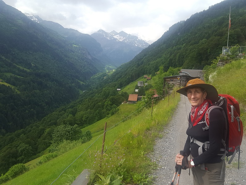
A morning transfer from Vaduz, Liechtenstein, to Sargans Castle in Switzerland provides an ideal start to your Via Alpina adventure. We will then make our way to Mels for a quick ascent to high alpine pastures where our route follows an undulating course through woods and meadows with relaxing views of the Weisstannental and its many waterfalls. We pass a dozen or more of these streams and rivulets cascading down the hillside. The Weisstannental is the canton of St. Gallen’s longest valley, and we arrive at our hotel along a mountain stream in the peaceful village of Weisstannen high in the valley. Overnight in Weisstannen. (BSD)
Ascent 2500 feet | Descent 1000 feet | Distance: 8 miles (may vary)
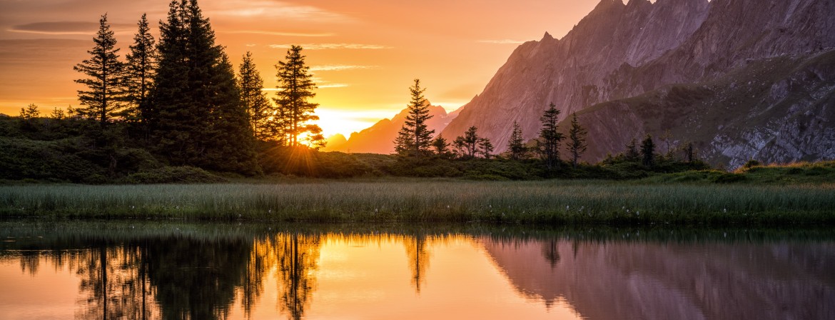
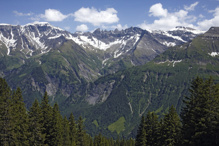
As we continue ascending the Weisstannental, the valley narrows and becomes more rugged, eventually passing above a dramatic chasm before reaching the high meadows of Fooalp. Crossing our first alpine pass, the Foopass (pronounced FOE-pass), brings us to 7,300 ft and offers a preview of the more challenging passes ahead. The descent to Elm rewards us with stunning scenery, as numerous waterfalls cascade down the hillsides. Elm lies at the heart of the Sardona Tectonic Arena, a UNESCO World Heritage Site and a geological marvel. The villages of the Glarner Alps are also known for some of Switzerland’s favorite specialties, including fine chocolates and pastries. Overnight in Elm. (BSD)
Ascent 3000 feet | Descent 4300 feet | Distance: 10 miles (may vary)
From Elm, you'll have a view of the Martinsloch, a giant hole in the Alps, and evidence of the geologic forces that formed and shaped this area. A morning bus speeds our ascent from Elm to a ski hut at Obererbs. It's a steep ascent to the narrow saddle which marks the Richetlipass at 7418 ft. And the descent from the pass remains unusually steep down to Unterstafel, so you'll need to be sure-footed and use trekking poles as we take our time going down. Arriving in the valley center of Linthal, you'll be relieved to have the funicular waiting to whisk you to the car-free alpine resort of Braunwald, set on a grassy slope with mesmerizing mountain views, including the glaciated Tödi massif, the highest mountain in the Glarner Alps. We spend the evening basking in the mountain views and starlit sky. Overnight in Braunwald. (BSD)
Ascent 2300 feet | Descent 5700 feet | Distance: 10 miles (may vary)
Today’s route follows a high path above the valley toward Urnerboden, the village at the head of Switzerland’s largest alp. The mountain scenery remains breathtaking and distinctly different from other Alpine landscapes—more reminiscent of the Dolomites. From Urnerboden, we’ll continue either by bus transfer or on foot toward the Klausenpass. A hotel has stood at the top of the Klausenpass since 1902, and the current hotel offers exceptional views along with warm, traditional hospitality. Overnight at Klausenpass. (BSD)
Ascent 1500-3300 feet | Descent 1450-1750 feet | Distance: 8-11.5miles (may vary)
The Klausenpass is a historic route that has been used for centuries as a trade route and to connect the hamlets and farms that dot both sides of the pass. Several great waterfalls along the route grab our attention, and the Stäuber waterfall above the hamlet of Äsch could certainly qualify as the most scenic undiscovered waterfall in Switzerland. As we descend the valley into Altdorf, we arrive in the old town of Bürglen, home of William Tell. The 16th-century chapel, built on the site of his house, and the Tell Museum offer a glimpse into the life and times of this Swiss hero. We travel to Altdorf, where there is a monument depicting William Tell with his crossbow and the iconic pierced apple. Overnight in Altdorf. (BSD)
Ascent 140-1090 feet | Descent 2860-4000 feet | Distance: 4.5-7.5 miles (may vary)
We cross the Reuss River, which descends from the historic Gotthard Pass, to start our day’s hike by taking a small cable car from the mountainside village of Attinghausen to Brüsti, just above treeline. The airy route to the Surenenpass ascends below the cliffs with the peaks of the Brunnistock and Blackenstock towering overhead. A large permanent snowfield makes for an efficient and speedy ascent route to the pass. Coming down, the views of Mt Titlis dominate the panorama. Overnight in Engelberg. (BSD)
Ascent 3050-3600 feet | Descent 2600-4470 feet | Distance: 10-12 miles (may vary)
With so much to do in the Engelberg mountain resort, it’s hard to call this a rest day. You’ll enjoy one of the great mountain excursions in the Alps as we ascend Mt Titlis, one of the giants of the Uri Alps, on the world’s first rotating cable car. At the summit, excursions include a glacier cave and cliff walk. In town, we may visit the 12th-century monastery, which houses the exquisite Baroque Abbey. You’ll still have time to explore Engelberg's pedestrian town center. Overnight in Engelberg. (B) Guests will have the opportunity to enjoy lunch and dinner on their own in Engelberg today.
Ascending above Engelberg, we enter an expanse of high alpine lakes and grassy meadows. We pass the Trübsee and cross the Jochpass to the Engstlensee. This is the realm of the marmot and hosts an amazing diversity of wildflowers. We have options on the ascent, choosing between a strenuous stretch or taking a more leisurely pace with the help of cable cars. Either way, we arrive at the traditional Alpine hamlet of Engstlenalp on the Engstlensee, where we stay at the Hotel Engstlenalp, a traditional mountain hotel dating to the 1860s. Overnight in Engstlenalp. (BSD)
Note: You will spend this evening in a Berghotel. You will have a private room with shared bathrooms on each floor. However, this hotel has 5 private rooms with en-suite bathrooms, which can be upgraded for $75 USD if available. Please arrange this directly with Alpenwild beforehand. Also, there is no elevator, and you may need to carry your luggage up a few flights of stairs.
Ascent 60-4150 feet | Descent 1270-1500 feet | Distance: 2.5-8 miles (may vary)
Departing Engstlenalp, we soon arrive at the charming alpine hamlet of Tannalp, home to a tiny church and a friendly herd of goats. Skirting the Tannensee, we ascend the Erzegg/Planplatten Ridge—a highlight of the Via Alpina and one of the Alps’ most spectacular ridge walks. Towering peaks and glaciers of the Bernese Alps unfold before you, with the massive Wetterhorn dominating the skyline. We then descend along the ridge into the lively town of Meiringen, famously known as the birthplace of meringues. Overnight in Meiringen. (BSD)
Ascent 2200 feet | Descent 980-3780 feet | Distance: 7-11 miles (may vary)
Meiringen sits at the base of four historic and strategic mountain passes, along the Aare River just before it flows into Lake Brienz. The town has long drawn international visitors, including Sir Arthur Conan Doyle, who set the dramatic death of Sherlock Holmes at nearby Reichenbach Falls. We’ll ascend the falls by funicular before continuing up the stunning Rosenlaui Valley. Our route takes us through a thundering gorge fed by the Rosenlaui Glacier, then over the final pass of our trek—the famed Grosse Scheidegg—leading to our flower-filled hotel with spectacular views of the Eiger’s North Face. Overnight in Grindelwald. (BSD)
Ascent 2200-4950 feet | Descent 500-3500 feet | Distance: 7.5-14.5 miles (may vary)
After breakfast, plan your departure or onward travel. Concluding the tour in Grindelwald, you're perfectly positioned to extend for a few extra days in this popular mountain resort. Consider taking the classic mountain railway excursion, which tunnels through the Eiger to arrive at the Jungfraujoch, the highest railway station in Europe, and overlooking the Great Aletsch Glacier, the longest in the Alps, or enjoy other hikes in the Jungfrau Region. Note: it is a 3-hour train ride to Zürich airport, and the first train departs Grindelwald at 5:15 am, so plan departure flights accordingly. We can recommend hotels in Zürich if needed. (B)
Daily distance measurements may vary depending on the device you use to track them. If a range is provided for the statistics, it is possible to hike closer to the lower end, and we’ll include options in your detailed daily directions. Use the listed figures as estimates and reference points while preparing and training for this tour.
We rate this trip as strenuous. You should be an experienced hiker in good physical condition. You should be capable of walking -7-8 hours per day on good trails with some steep ascents and descents, averaging 2500-4000 vertical feet per day at an elevation up to about 8000 feet above sea level. Sure-footedness is important and if you have a history of severe vertigo, it may impact your ability to do this tour.
Please note that on Day 4, there is a descent of about 5600 feet, for which there is no lift or public transportation to reduce the descent. The other days may list a range on the stats, meaning that there are ways to shorten the hikes if needed, with lifts or local transportation. The group tours will generally hike on the upper side of the stat ranges. Trekking poles are highly recommended on this tour.
Assume 2.5 miles/hour on the flat.
Assume 1200 feet of up per hour.
Assume 2000 feet of down per hour.
